Forecast Update 05/05/26: Long Slow Front, Cool Weather Continues
- Geddy Davis
- May 5
- 3 min read

After a weekend which saw widespread frost/freeze conditions in the early mornings, especially in parts of western and southern Ohio, Monday gave us a warm start to the week with temperatures rising into the 70°F range across the state. A fairly marginal risk for scattered severe thunderstorms in parts of Northwest Ohio held off producing anything of interest until after dark, as a slow moving cold front finally began its approach to the region. Clusters of moderate rain did move in eventually overnight, producing little of note.
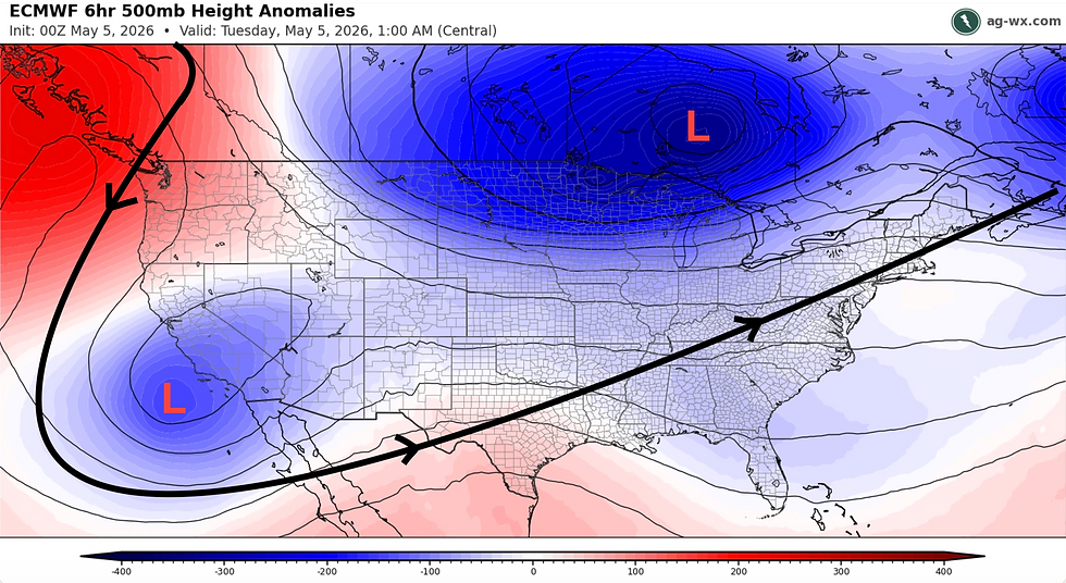
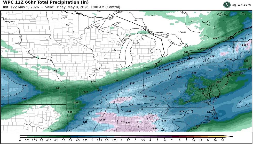
This slow-moving front will be the main focus of the outlook today and Wednesday, as it stalls out across Northwest Ohio this morning. Ahead of the front, a steady stream of moisture will lead to periods of rainfall today through Wednesday night over much of the state along with a few opportunities for embedded thunderstorms. This sudden influx of moisture is thanks in part due to the interaction of our persistent Hudson Bay low pressure pattern and a new low pressure trough that has advanced from the west coast of the U.S. The interaction, or "phasing", of these two systems will help to prolong the presence of this frontal boundary until it finally clears the state early on Thursday morning.
The slow progression of this front begins today as mentioned, with a wide swath of rain expected, some of which may be heavy at times or feature some rumbles of thunder. In spite of the consistent rain and grey skies, a majority of the state will remain warm with high temperatures in 70-75°F range. The exception to this will be portions of far northwest Ohio, generally northwest of US 24, where temperatures behind the front will be in the low to mid 60s. Rainfall will continue through the night and into Wednesday morning, before the front finally resumes its slow drop to the southeast. Rain will gradually taper off from northwest to southeast throughout the day Wednesday, before officially moving out of southeast Ohio by Thursday morning. Statewide rainfall totals of 0.50-1.50" are expected, with a few areas seeing higher or lower totals.
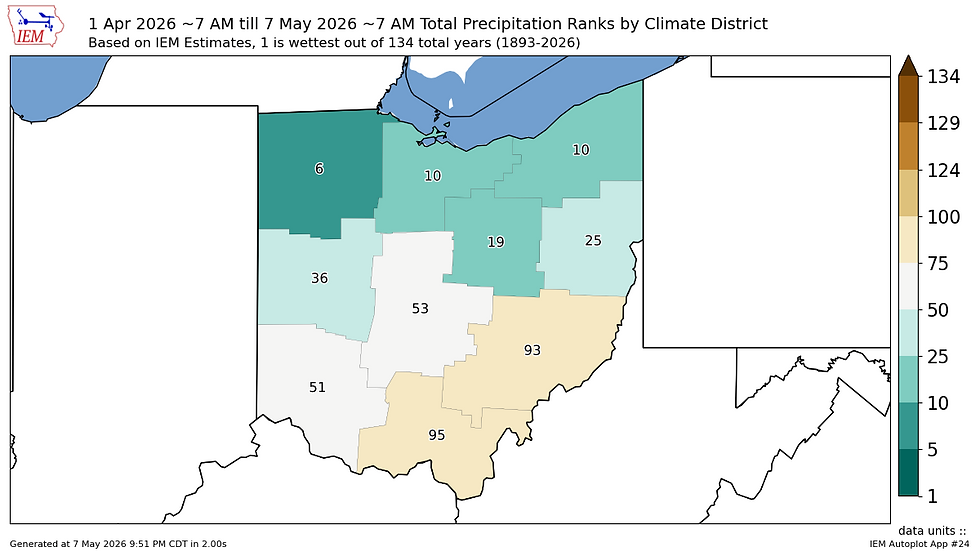
As the front pushes through, we will again see another slug of cooler than average air in the aftermath. Highs around the state on Wednesday and Thursday will be in the upper 50s/low 60s, with lows in the upper 30s/low 40s. Unlike this past weekend, this airmass will not be as potent, which should mitigate any widespread frost risk. That said, its more reinforcement for what has been one of the coolest starts to the month of May in recent memory.

Tomorrow's post will look at the progression of this current weather system, as well as our next set of distrubanes that look to keep the cool, wet pattern going through Mother's Day Weekend.
GRD